Home | Places to Explore | Attractions
Niagara River Parkway
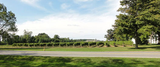
The Niagara River Parkway stretches out from Niagara-on-the-Lake in the north to Fort Erie in the south. For 55 kilometres the Niagara Parkway hugs the Niagara River, offering unsurpassed views of the Niagara River and Niagara Falls.
The Niagara River Parkway winds it's way along the Niagara River, passing through towns such as Chippawa and Queenston, as well as Niagara Falls. Alongside the entire length of the Niagara Parkway runs the Niagara River Parkway Recreational Trail.

In 1943 Sir Winston Churchill described the Niagara River Parkway as the "prettiest Sunday afternoon drive in the world". However, long before Churchill or the arrival of the first tourist the Niagara Parkway was already being used by the aboriginal people to portage around Niagara Falls as they travelled between Lake Ontario and Lake Erie.
When the area was being surveyed in 1786 the British military requested that one chain or sixty-six feet be set aside along the entire length of the Niagara River from Fort Erie to Fort George. Over the years farmers tended to disregard this chain-length reserve rule however all that would change with the formation of the Niagara Parks Commission.

From it's early beginning in 1885, the Niagara Parks Commission began purchasing property along the River Road, which it was known as at the time. Over the next forty years the number of acres owned by the Park had increased from the initial 155 acres to 1,700 acres.
They initiated the construction of parks at Fort Erie, Niagara Falls, Niagara Glen and Queenston Heights. A parkway that would become known as the Niagara River Parkway would connect all the parks making accessibility from one park to the next possible.

